Geography & the World · Cities & settlements
Why cities grow where they do
Use Chicago and a simple business cluster to see how location, transport networks, crowding together and the costs of crowding shape where a city grows.

What you will learn
- Connect a settlement's physical location with the transport networks around it.
- Explain how infrastructure can change the usefulness of a location.
- Predict how a new route changes the usefulness of places on it and places off it.
- Explain how firms and workers can gain from being close together.
- Explain why a larger specialized market doesn't guarantee that every firm benefits.
- Predict which activities gain most from being close to others and which gain least.
Lesson 1 of 4 · 5 min
Why did Chicago become a crossroads?
Chicago became a city in 1837. It had started as a small trading post at the mouth of the Chicago River. By 1883, just 46 years later, it had grown more than 100-fold and was one of the largest cities in the United States. Why there?
The answer is older than the city. The region sits on a low divide between two great water systems. On one side, water drains to the Great Lakes. On the other, it runs toward the Mississippi. Indigenous peoples traveled through the area because those waterways meet there.
Geographers split a location into two ideas. A place's site is the ground it stands on. For Chicago, that's a river mouth on a lake shore. Its situation is where it sits in relation to other places.
A fine site is worth little if it leads nowhere. Chicago's river mouth mattered because of where the routes led. One way lay the Great Lakes. A carry across the divide lay rivers running to the Mississippi.
In 1848, the Illinois and Michigan Canal replaced that carry with water. It ran 96 miles from the Chicago River to the Illinois River, and from there boats could reach the Mississippi. Goods could now go by water between the Great Lakes and the Mississippi River system.
A street map of Chicago can't explain what happened next. The canal joined two transport networks, and the city stood at the join.
A rival arrived the same year. In October 1848, Chicago's first locomotive was delivered. It came by sailing ship across the Great Lakes, because no track reached the city yet.
That month the secondhand engine, known as the Pioneer, made its first run. It took a group of prominent citizens out of town and came back with them and a load of grain. More lines spread out through the 1850s, and the harvest of the region began arriving by rail.
Each link built on the one before, but geography didn't build any of them. People paid for the canal and the track, ran businesses along them and moved to Chicago for the work.
The location offered an opening. Investment and institutions turned it into a hub. An explanation of Chicago needs both the physical position and the human decisions.
Railroads soon made the canal obsolete. Chicago kept growing, because the railroads met there too. By the city's own count, 50% of US rail freight still passes through Chicago.
Its latitude and longitude never changed. What changed, twice in a decade, was what you could reach from it. Part of a city's location is its networks, and networks have histories.
Try to recallHow can a new canal or railway make a town's location more useful without moving the town?
It connects the town to more routes, markets or suppliers. The town stays where it is, but what it can reach through the network changes.
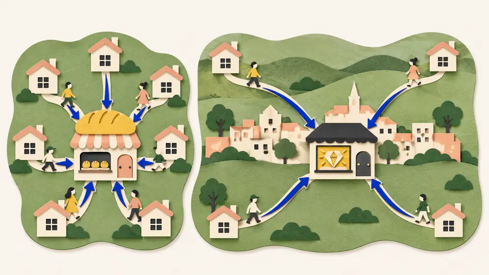
A new route changes the value of many places at once, including places it never touches. The canal itself showed that within five years. From 1848 to 1852 it was a popular passenger route. Then a railroad opened alongside it in 1853, and the canal's passenger service ended.
Nothing was wrong with the canal. Its water, locks and towpaths were the same as the year before. A faster route had opened next to it.
Towns can lose the same way. Say a town prospered as a handy stop on an older, slower route. Then the canal and the rail lines meet at Chicago, and none of them passes the town.
The town keeps its river, its harbor and its soil. What it loses is its position in the network, and that was never the town's to keep. It came from the arrangement of routes around it.
So when a place thrives or fades, look outside its boundaries as well. The cause may be a route built somewhere else.
A route only creates an opportunity, though. People and firms still decide whether to pay for it, use it and build beside it. Chicago had both, a meeting point of routes and people willing to invest in it.
Lessons in this topic
Why did Chicago become a crossroads?
See how a canal and then railroads turned a small trading post into the place where the country's routes met, and what a new route does to places it leaves out.
Why do businesses choose expensive neighbors?
Use a specialist repair workshop to see what a business gets for high city rent, and which kinds of business get the least from it.
When does a growing city stop working?
See how fast growth strains homes and transport, why a rising population doesn't prove better lives, and what shortens the distance that really separates people from jobs.
The city that raised its streets and reversed its river
Chicago burned in 1871 and was rebuilt in the same place. See why the site kept its value, and how the city lifted its streets and turned its river around to keep living there.
Three quick stories from this topic
Chicago's first locomotive
Chicago's first locomotive arrived in 1848 on a sailing ship
No track reached the city yet, so the secondhand engine crossed the Great Lakes by boat. Rail lines spread out from Chicago through the 1850s. By the city's own count, half of US rail freight still passes through it.
The routes already met there
Chicago was a trading center before the trains came. In 1848, the same year, a canal linked the Great Lakes with the Mississippi River system.
A place is worth what it reaches
Each new route multiplied the places Chicago could trade with. The city never moved. Its connections did the growing.
A billion people in slums
By 2022 more than 1 billion people lived in slums, nearly 1 in 4 city dwellers
The total rose by more than 160 million in four years, from about 840 million in 2018. Slums grow where the demand for affordable homes near a city goes unmet, so a city can gain millions of people while living conditions fall behind.
A falling share can hide a rising number
In a fast-growing city, the share of residents living in slums can hold steady or fall while the number of people in them keeps climbing.
Growth isn't development
Population growth counts residents. Development asks about their housing, health and services. The World Bank's advice is to build roads and services before the people arrive.
Chicago's backward river
Chicago made its river flow backward in 1900 to keep sewage out of its drinking water
The Chicago River used to carry the city's sewage into Lake Michigan, where the city also drew its drinking water. A new canal cut through a low ridge sent the river the other way, toward the Mississippi.
A city that re-engineered its site
The reversal followed earlier works. In the 1850s, Chicago raised streets by five to eight feet to install sewers, then raised the buildings too. After the 1871 fire, debris dumped into the lake became the base of today's Grant Park and Millennium Park.
Growth made the problem
The lake and river drew the city, and then the city's waste turned them into a hazard. A site sets the starting conditions, but a growing city can alter its ground and water in response, and that comes at a cost.
Sources
- Chicago history, City of Chicago
- Chicago Sanitary and Ship Canal, Wikimedia Foundation
- Illinois and Michigan Canal, Wikimedia Foundation
- The Pioneer: the little locomotive that could, Chicago History Museum
- Pioneer (locomotive), Wikimedia Foundation
- Building productive cities for an urbanizing world, World Bank