Geography & the World · Resources & land use
The Mekong, one river shared by six countries
Follow the Mekong's water across six countries, watch Tonle Sap reverse with the seasons, and see why sharing river data helps neighbors cooperate.

What you will learn
- Explain a river basin as one connected drainage area.
- Explain why national borders don't contain everything that affects a shared river.
- Describe the seasonal connection between the Mekong and Tonle Sap Lake.
- Explain why the timing of a river's flow matters as well as its yearly volume.
Lesson 1 of 4 · 3 min
Why the Mekong belongs to six countries at once
The Mekong runs nearly 5,000 kilometers, from the Tibetan Plateau to the sea, through six countries. On a map it's a thin blue line. But its water comes from far beyond that line.
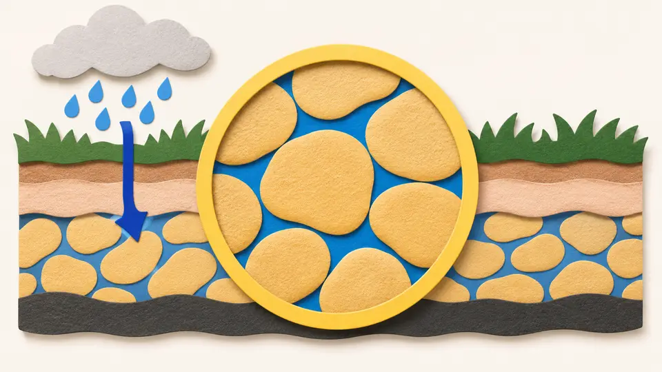
Tributaries, the smaller rivers and streams that join a river, carry that water in. All the land that drains into the river system is its basin. So what happens on a hillside far from the Mekong can change the water flowing past a town downstream.
The Mekong's basin takes in parts of China, Myanmar, Thailand, Laos, Cambodia and Vietnam. A political map cuts it into six pieces. A basin map shows the water tying those pieces together.
The Mekong River Commission divides the basin in two. The upper basin lies in China, where the river is called the Lancang, and makes up 24% of the whole. The lower basin is everything downstream of the border between China and Laos.
Those borders matter because of who lives below them. The Commission estimates that nearly 65 million people live in the lower basin, and that about 80% of them depend on the river and its resources for their livelihoods.
The river they depend on holds about 850 known species of fish. None of that water, and none of those fish, stops at a border post.
Upstream and downstream are positions along the flow. A change upstream travels well beyond the place where it began. Hold water back in one country, or pollute it, and the next country's river is lower or dirtier.
So when a river system crosses borders, the amount and quality of its water become shared concerns. A decision made in one capital is felt by people who had no say in it.
It's tempting to picture a river as a pipe that carries a fixed amount of water from source to sea. A river doesn't work that way. Tributaries add water along the route, the seasons raise and lower the flow, and people draw water off in different places.
The Mekong runs through highlands, plateaus, floodplains, a great lake and a delta. Each of them changes how the whole river behaves.
So when you read that a river is low, flooding or dirty, don't stop at the border. Ask where in the basin the change began. Ask when that water arrives downstream. And ask who depends on it when it does.
Borders tell you who has authority over each stretch. The basin tells you where the water comes from.
Try to recallWhy can't a map of one country's section of the Mekong show everything that affects the river's flow there?
Water reaches that section through upstream channels and tributaries that extend beyond the country. Seasonal conditions and activities elsewhere in the basin can affect it too.
Lessons in this topic
Why the Mekong belongs to six countries at once
See how a river basin gathers water from land far beyond the channel, and why the borders drawn across the Mekong's basin can't contain what happens in it.
The river in Cambodia that flows both ways
Watch the Tonle Sap River reverse with the seasons and its lake grow sixfold, and see why the timing of a river's flow matters as much as its yearly total.
Who manages the Mekong when six countries share it?
Separate the six-country Mekong basin from the four-member commission, and see what two gauging stations in China do for forecasts downstream.
What dams do to the Mekong's seasons and silt
Predict how storage dams reshape the Mekong's seasonal flow and sediment, and see why the costs and benefits land in different countries.
Three quick stories from this topic
The river that flows both ways
A river in Cambodia reverses direction every year and makes its lake six times larger
In the dry season the Tonle Sap River drains its lake into the Mekong. In the wet season the swollen Mekong pushes it backward, and the lake spreads from about 2,500 square kilometers to about 15,000. About 40% of Cambodians depend on that flood for food and income.
The lake spreads and shrinks
Water flowing in during the wet season spreads the lake over its floodplain. When the flow turns around, the lake drains and shrinks back.
A fixed outline misses the cycle
The seasonal connection supports the lake's ecosystem and local livelihoods. That's why the timing of the water matters as well as the total volume.
Flood warnings from upstream
Two river gauges in China help forecast floods for four countries downstream on the Mekong
In 2002 China agreed to send daily river-flow and rainfall readings from two stations in Yunnan each wet season. They go to the Mekong River Commission, which China never joined. Water passing those stations is heading for Laos, Thailand, Cambodia and Vietnam.
Six countries, four members
Six countries share the Mekong basin. Only Cambodia, Laos, Thailand and Vietnam signed the 1995 agreement that set up the Commission. China and Myanmar are its dialogue partners.
Why upstream readings help
Readings taken upstream show what's on its way downstream, so they improve the Commission's daily forecasts of water levels in the flood season. In 2013 China raised the readings to twice a day.
Silt that never reaches the delta
Dams upstream trap the silt that keeps the Mekong Delta fertile
A dam holds back sediment as well as water. The Mekong River Commission says that flow of sediment maintains the delta's fertility and supports its farming and fisheries. So a dam built for electricity in one country can cost a farmer soil in another.
A basin filling with reservoirs
The Commission counts 12 operational mainstream dams on the Lancang in China, and 98 projects in Lao PDR that make up 64% of the lower basin's installed capacity. Reservoirs also change when the water flows, and they can block fish migration.
Benefits here, costs downstream
Electricity and regulated flows benefit the place where a dam stands, while the loss of sediment reaches the delta in another country. The Commission sees that cross-border effect as a reason for joint planning, design guidance and benefit-sharing.
Sources
- Geographic regions, Mekong River Commission
- Mekong River Basin, Mekong River Commission
- Dialogue and partnership, Mekong River Commission
- Hydropower, Mekong River Commission