Geography & the World · Countries & regions
The Wallace Line and the animals it divides
Bali and Lombok are about 35 kilometers apart, yet Asia's animals stop at the strait between them. See why the depth of that water matters more than its width, and why the line keeps being redrawn.
What you will learn
- Say where the Wallace Line runs and what changes on either side of it
- Explain why some groups stay on one side of the line and others cross it
- Explain why a narrow strait has separated two faunas for tens of millions of years
- Describe the Sunda Shelf and what the low sea levels of ice ages do to it
Lesson 1 of 4 · 5 min
The line between Bali and Lombok that animals don't cross
On his travels through the East Indies, the British naturalist Alfred Russel Wallace crossed from Bali to Lombok. The islands are only about 35 kilometers apart. On Bali he saw woodpeckers and barbets. On Lombok those were gone, and he found cockatoos and brush-turkeys, birds unknown on Bali or any island to its west.
He wrote that in two hours you could pass between two divisions of the earth that differ in their animal life as much "as Europe does from America."
The boundary he drew in 1859 is the Wallace Line. It's a faunal boundary, a line where one set of animals gives way to another. It runs through Indonesia, along the Lombok Strait between Bali and Lombok and the Makassar Strait between Borneo and Sulawesi.
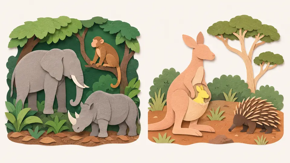
West of the line the animals are Asian. There are placental mammals such as apes, cats, elephants, monkeys and rhinoceroses, and no marsupials, the mammals that carry their young in a pouch.
East of it begins Wallacea, a zone of islands where animals of Asian and Australian origin mix. Beyond lie Australia and New Guinea, with their many marsupials and a few egg-laying monotremes. There are exceptions, such as the macaques and pigs on Sulawesi, but the overall pattern is consistent.
So which living things stop at the line? The ones least able to cross open water. Many bird species have ranges that end there, because many birds won't cross even a short stretch of open sea. Bats fly across it. Larger land mammals are generally limited to one side or the other.
Plants follow the line less closely, because they differ in how easily they spread across water. The Australian genus Eucalyptus stops at the line with one exception, a single species that grows naturally on Sulawesi and on Mindanao in the Philippines.
Those exceptions are what make the line useful. The islands on either side are physically much alike, so climate and landscape don't explain it. And if every living thing respected the line, you'd know only that some barrier exists.
But walkers and reluctant fliers stop, bats cross and plants follow it loosely. That tells you what kind of barrier it is. It's open water, which is no obstacle to a strong flier.
Try to recallBats cross the Wallace Line and larger land mammals don't. What does that difference tell you about the barrier?
It tells you the barrier is open water, rather than climate or habitat. Many birds won't cross even the shortest stretch of open ocean, so their ranges follow the line closely. Bats fly far enough to cross, so theirs don't. Larger land mammals are generally limited to one side. So the line sorts living things by how well they spread over the sea. That's also why plants follow it only loosely, since they differ in how easily they spread over water.
So the Wallace Line is a record of who could cross the sea. Land mammals and many birds stopped at the strait, while bats and a few plants got over. About 35 kilometers of water was enough to keep two sets of animals apart.
Lessons in this topic
The line between Bali and Lombok that animals don't cross
Bali and Lombok are about 35 kilometers apart, yet Asia's animals stop at the strait between them. See where the Wallace Line runs and which living things it holds back.
Why the Lombok Strait's depth matters more than its width
The Lombok Strait is narrow but at least 250 meters deep. See why that kept Asia's and Australia's animals apart even when ice ages drained the shallow seas around them.
The lost rivers under Indonesia's shallow seas
When ice ages lowered the sea, great rivers crossed a plain between Sumatra, Java and Borneo. See how they're mapped today and what the repeated flooding did to wildlife.
Why the Wallace Line keeps being redrawn
Wallace wasn't the first to notice the contrast, didn't name the line, and didn't draw the version that carries his name. See why scientists keep moving it.
Three quick stories from this topic
Walking to Bali
During the last ice age, you could have walked from mainland Asia to Bali
The sea stood up to 120 meters lower, and the seabed around Sumatra, Java, Borneo and Bali is rarely more than 50 meters down. It dried into a marshy plain crossed by great rivers, whose valleys can still be traced on the sea floor.
The Sunda Shelf
The shallow ledge under those islands covers about 1.85 million square kilometers. Exposed, it formed a landmass that biogeographers call Sundaland.
Where the walk ended
The Lombok Strait, just east of Bali, is at least 250 meters deep. No ice age drained it, so Lombok stayed an island and Asia's land mammals stopped at Bali.
Bali and Lombok
A 35-kilometer strait between Bali and Lombok marks the edge of Asia's animal world
On Bali the naturalist Alfred Russel Wallace saw woodpeckers and barbets. On Lombok they were gone, and he found cockatoos. The strait between the islands is at least 250 meters deep, so it stayed sea when ice ages joined Bali to Asia.
Marsupials start here
East of the line you find many marsupials, some monotremes, and rodents from later colonization. West of it there are apes, cats, elephants, monkeys and rhinoceroses, and no marsupials at all.
Bats cross, big mammals don't
Many birds won't cross even the shortest stretch of open ocean, so their ranges follow the line. Bats fly over it, and plants follow it only loosely.
Not quite Wallace's line
Wallace didn't name the Wallace Line, and the famous version isn't the one he drew
Alfred Russel Wallace proposed a line east of Bali in 1859 and left the Philippines out of his paper. In 1868 Thomas Henry Huxley redrew it to run west of the Philippines and named it after him. Scientists were still proposing changes in 2020.
Then others drew their own
Sclater drew one in 1894 and Lydekker in 1896. Pelseneer's version of 1904 is known as the Weber line, and Mayr's followed in 1944, along with smaller subregional boundaries.
Still moving in 2020
A study of Christmas Island's animals proposed moving the line so the island sits on the Australasian side. Otherwise, geospatial reassessments have reproduced the nineteenth-century divisions.
Sources
- Wallace Line, Wikimedia Foundation
- The Malay Archipelago, Volume 1, Alfred Russel Wallace, 1869 (Project Gutenberg)
- Sunda Shelf, Wikimedia Foundation
- Lombok Strait, Wikimedia Foundation
- Towing the line, The University of Hong Kong Bulletin