Science · Earth & its history
Plate tectonics and moving continents
Earth's outer shell is broken into plates that move a few centimeters a year. See what drives them, what they build where they meet, and how the seafloor and Hawaii's islands recorded the motion.
What you will learn
- Explain how rigid plates can move above slowly deforming rock.
- Tell plate motion apart from the idea that continents drift alone through stationary oceans.
- Tell divergent, convergent, and transform boundaries apart by their motion.
- Explain how seafloor can be created and subducted without Earth continually expanding.
Lesson 1 of 4 · 3 min
How can solid ground move?
About 200 million years ago there was no Atlantic Ocean, only a narrow inlet between Europe, Africa and the Americas. It has been widening ever since.
It widens because Earth's rigid outer shell is broken into plates that move, a few centimeters a year, carrying ocean floor and continents with them. So how does solid rock travel?
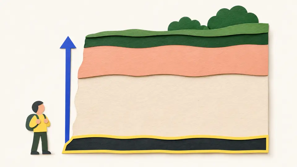
Solid doesn't have to mean unable to change shape. Heat and pressure can soften steel enough to reshape it while it stays solid. The hot rock beneath the plates behaves the same way. Pushed steadily for millions of years, it flows very slowly.
So there's no global ocean of lava with continents floating on it like rafts. The plates are a rigid layer riding on hot rock that creeps.
Something has to keep the plates moving. Partly, the hot rock below circulates like thick soup on a stove, rising where it's hot and sinking where it has cooled. The rock just does it far more slowly.
The bigger force seems to come from the plates themselves. At a subduction zone, the cold, dense edge of a plate sinks into the interior and pulls the rest of the plate along behind it. Geologists still argue over the details. That the plates move isn't in doubt.
A plate isn't a continent. The North American Plate carries the continent and also the Atlantic floor as far east as the middle of the ocean. Its edge cuts through Iceland, which sits on two plates at once.
Coastlines mislead too. In California, the land west of the San Andreas fault belongs to the Pacific Plate. A plate is whatever part of the rigid shell moves together, above sea level or below it.
So the Atlantic didn't widen because continents plowed through the ocean floor. Down its middle runs the Mid-Atlantic Ridge, an underwater mountain range where two plates pull apart. Magma rises into the gap and hardens into new ocean crust.
The new floor rides away from the ridge on each side, like two conveyor belts running in opposite directions. The continents travel with it, each as part of its plate.
The Mid-Atlantic Ridge spreads about 2.5 centimeters a year on average. In a million years that's 25 kilometers. Keep it up for 100 to 200 million years and you get an ocean thousands of kilometers wide.
These speeds aren't only inferred from old rock. Satellite positioning now measures the plates as they move, and the rates match.
Try to recallWhy is it misleading to picture continents sliding independently across a permanently fixed ocean floor?
A plate carries ocean floor as well as continent, and the two move together. New ocean floor forms at a spreading ridge such as the Mid-Atlantic Ridge and moves away on both sides, so the floor between the continents is itself growing and moving.
Lessons in this topic
How can solid ground move?
See how rigid plates ride on hot rock that flows slowly, and why a plate isn't the same thing as a continent.
What happens where plates meet?
Plates pull apart, collide or slide past each other. See what each motion builds, and why new seafloor doesn't make Earth any bigger.
What convinced scientists the seafloor moves?
Magnetic stripes, drilled rock and earthquake maps each tested the idea that the seafloor spreads. See why all three pointed the same way.
How Hawaii's islands record the Pacific Plate's path
Read the ages of the Hawaiian Islands as a track of plate motion, and see which part of the hotspot idea the ages can't prove.
Three quick stories from this topic
Seafloor magnetic stripes
The seafloor's magnetic stripes were found with instruments built to hunt submarines
In the 1950s, scientists surveyed the ocean floor with magnetometers adapted from World War II submarine detectors. They mapped zebra-like bands of rock magnetized in opposite directions. Cooling lava locks in the direction of Earth's magnetic field, and that field has flipped many times.
The stripes mirror each other
The bands on one side of a mid-ocean ridge match the bands on the other side. New crust forms at the ridge, records the field of the day, and is carried away in both directions.
Drilling confirmed it
In 1968 the drilling ship Glomar Challenger sampled the seabed across the Mid-Atlantic Ridge. The rock was youngest at the ridge and older with distance, as spreading predicts.
East Africa is splitting
East Africa is slowly splitting, and the Horn of Africa could end up as an island
Spreading has already torn Arabia away from Africa and opened the Red Sea. If the East African Rift keeps widening, geologists expect the Indian Ocean to flood in, much as the Atlantic began to open about 200 million years ago.
A spreading boundary on land
Where plates pull apart, the crust stretches and cracks, and magma rises through the gaps. In East Africa that's happening under a continent instead of under an ocean.
How an ocean starts
The Atlantic began as a narrow inlet between Europe, Africa and the Americas. About 2.5 centimeters of spreading a year, kept up for 100 to 200 million years, made it an ocean.
Pele's route matches the dates
A Hawaiian legend lists the islands in the same age order geologists later measured
Pele, the volcano goddess, lived first on Kauai, then fled to Oahu, Maui and finally Hawaii. That route runs from the oldest island to the youngest. Hawaiian voyagers had read the order from erosion, soil and vegetation, centuries before anyone dated the rocks.
A goddess's journey southeast
That knowledge lived on in the legends of Pele, the volcano goddess. She lived first on Kauai, then fled from her sister, the sea goddess, to Oahu, then Maui, and then Hawaii, where she now lives at Kilauea. Her route runs from the oldest, most eroded island to the youngest and most active one.
The dates agree
Geologic evidence later matched that order. Kauai's oldest rocks are about 5.5 million years old, while the Big Island's oldest exposed rocks are under 0.7 million years old, and new rock still forms there. The legend alludes to the contest between eruption and erosion that the hotspot model explains.
Sources
- Understanding plate motions, U.S. Geological Survey
- Some unanswered questions, US Geological Survey
- Developing the theory, US Geological Survey
- Hotspots, US Geological Survey